Beautiful Karamursel
Beautiful Karamursel
Southwest USA - Part 1
Southwest USA - Part 1
(Unless noted, all photos were taken by Mike Holland and Michelle Holland on this trip.)
To me, the most beautiful mountains in America are the Rockies. They are high, desolate, jagged, and grand. The last time I made a trip to the area around Arizona was in the year 1968 as a teenager with my family. My how time flies. My wife Beth and I had taken our children (who are now grown) to other places around the USA but not to that area. We were waiting for an ideal time to go, but one never came. Finally, we made a plan. My younger daughter Michelle and I would make a car trip, and Beth would remain home to take care of the dogs, flowers, and house. COVID-19 warnings or not, we would go. It turned out to be a great trip, and it was interesting to talk with others at the parks and hear their ideas on traveling this year. Most were sick and tired of the COVID restrictions and just wanted to travel and be free again. Remember the statement by General John Stark of the Revolutionary War: “Live Free or Die.” That was the spirit of the people who we met while traveling. They wanted to see the majesty and grandeur of God’s creation and feel the expanse and wonder of being in wide-open spaces again. People from all over the world are adventurous and love to venture into the unknown. It surprised Michelle and me how many different languages we heard. There were a lot of international travelers enjoying our national parks.
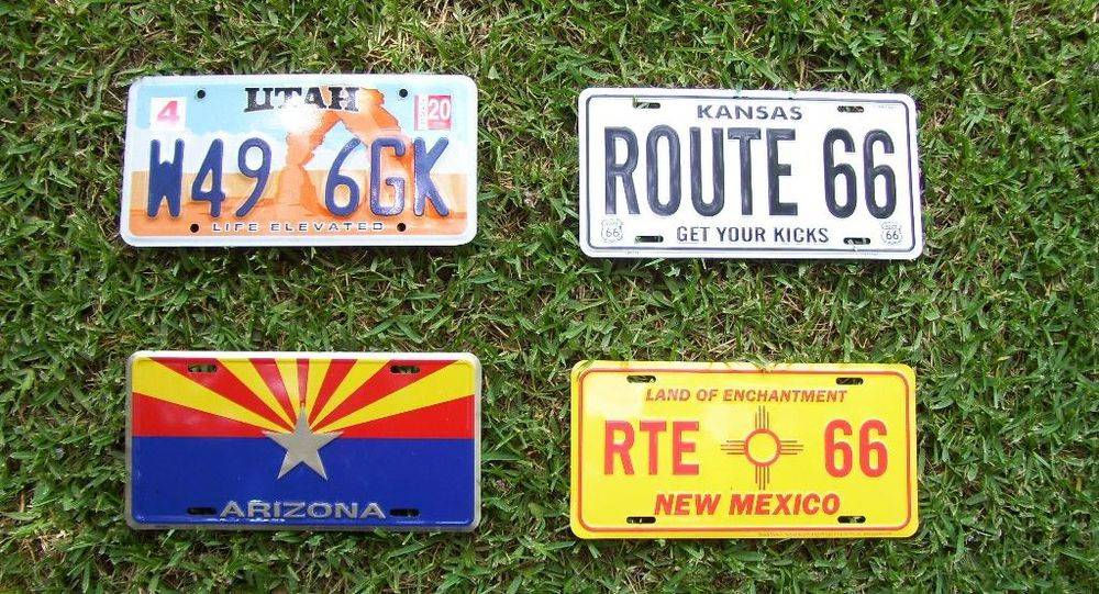
Souvenir license plates from our trip.
Souvenir license plates from our trip.

Stopping to eat.
Stopping to eat.

Photo by Gabriel Cristóver Pérez
Photo by Gabriel Cristóver Pérez

La Mesa Motel in Santa Rosa, NM
La Mesa Motel in Santa Rosa, NM

Unloading Car
Unloading Car

You can see the landscape behind the motel.
You can see the landscape behind the motel.
SECOND DAY – Sunday, May 15
We were looking for a station that we had a gas credit card for but could not find one. Driving into New Mexico, the stations were often Allsup’s and Maverik. A regular credit card worked in all of them, so we experienced no problems.
We filled up with gas at a Maverik station and then headed west on I-40. Interstate 40 parallels or runs over most of the old Route 66 in the Southwest. My daughter had a Route 66 book along with us, so we looked up interesting stops and pulled over to check them out as we drove along. It was fun to visit all that nostalgia along the old highway. There were lots of gift shops with souvenirs to buy.

Since the 1930s, Clines Corners has been a popular stop for travelers along I-40/Route 66 in New Mexico.
Since the 1930s, Clines Corners has been a popular stop for travelers along I-40/Route 66 in New Mexico.

Inside Clines Corners Travel Center.

We stopped to eat lunch at the Route 66 Travel Center on our way to Albuquerque, NM.

Michelle making a sandwich.
Michelle making a sandwich.
At Albuquerque, NM, we pulled off the interstate to drive the length of the old Route 66 through the city. We enjoyed seeing all of the midcentury motels, restaurants, gas stations, and signs.

A sign in Albuquerque highlighting the Mother Road.

The opulent Kimo Theatre in Albuquerque, which features art-deco style.
The opulent Kimo Theatre in Albuquerque, which features art-deco style.

We hadn’t planned to stop at the Continental Divide, but the traffic was almost at a standstill due to construction. We needed a breather and so exited to look around at a couple of souvenir shops and eat some ice cream.

Yellow Horse Gift Shop in Lupton, AZ.

The Rainbow Rock Shop in Holbrook, AZ.

This town loves dinosaurs! We spotted these as we drove around.

The Econo Lodge in Holbrook, AZ.

The lunar eclipse on Sunday, May 15, 2022.
That night we had a great view of the “blood moon,” or total lunar eclipse, just outside our motel room. We and other guests were talking about it and watching it through binoculars.
The interstates make quick time of a lot of miles. We were doing well and still ahead of schedule. Since we were getting close to the Grand Canyon, Michelle made hotel reservations online for the next two nights. She thought we might get to the towns after dark and wanted to make sure we had a room to spend the night in. She was right!
THIRD DAY – Monday, May 16, 2022
The next morning we filled up the gas tank at the Maverik station in Holbrook. The day before we had driven past Petrified Forest National Park to spend the night so that we could start viewing the park fresh the next morning. To reach the park, we backtracked east down Highway 180 to Woodruff.

Overloaded car with a big chunk of petrified log in the back.

Here we turned north and drove through the park, which was just beautiful with many different rock formations and colors. The park road passes over I-40 and then makes a circle back to the visitor center to the north entrance on I-40.

At the entrance to all the national parks they give you excellent maps with the lookout points, trailheads, and bus routes recorded. Be sure to study them carefully before you begin your adventure. They will make your trip much more effective and timely.

Inside the visitor center, we explored the informational Rainbow Forest Museum.

When polished the colors are just beautiful.


A beautiful determined flower in the middle of a desert.
A beautiful determined flower in the middle of a desert.


Notice the walking trail down in the canyon.

Another walking trail. If you look carefully, the small specks along it are people.
Another walking trail. If you look carefully, the small specks along it are people.

After finishing up at the park, we drove back onto the interstate and headed west again.

Billboard at the Jack Rabbit Trading Post on Route 66 in Joseph City, AZ.

We both wanted our picture taken in front of this fun sign!

A large cycling group met at the Jack Rabbit Trading Post that day and set off down Route 66 as we walked inside.

Entering Winslow, AZ.

Of course we had to stop in Winslow, AZ, to pay homage to the Eagles.

Cool red truck.
Cool red truck.

The Eagles’ song “Take It Easy” is about this corner.
The Eagles’ song “Take It Easy” is about this corner.


After Winslow we stopped at one pullout famous for good views of passing BNSF trains. This is exit 211 on I-40. It’s a great place to film trains. You will need your telephoto lens and a tripod, because the trains are in the distance.
After Winslow we stopped at one pullout famous for good views of passing BNSF trains. This is exit 211 on I-40. It’s a great place to film trains. You will need your telephoto lens and a tripod, because the trains are in the distance.

Trains come through here often, you don't have to wait long.
Trains come through here often, you don't have to wait long.

Williams Depot in Williams, AZ, where the Grand Canyon Railroad departs in the early morning and returns in the late evening. It runs all the way to Grand Canyon Village at the South Rim near the El Tovar Hotel.

In 1901, the Santa Fe Railroad completed a 64 mile branch line from Williams to Grand Canyon Village at the South Rim. The first scheduled train to carry paying passengers of the Grand Canyon Railroad arrived from Williams on September 17 of that year. To accommodate travelers, the Santa Fe designed and built the El Tovar Hotel, just 20 feet from the Canyon Rim.
The hotel is one of the Harvey House facilities that are still in operation, and is an early example of the style that would evolve into National Park Service Rustic architecture.


Grand Canyon Inn in Valle, AZ.

Next to the Inn was a filling station/museum with lots of antique classic cars.

A beautiful blue 1957 Chevrolet.
A beautiful blue 1957 Chevrolet.
FOURTH DAY – Tuesday, May 17, 2022
What an exciting morning to think that in just about an hour we would have our first view of the South Rim at the Grand Canyon. I had been thinking about this for years and now it was a reality. We entered the park and stopped first at the visitor center on the rim of the canyon, and from there we walked to Mather Point for the first look. Wow, indescribable! The expanse, vastness, size, and beauty of the canyon just takes your breath away and gives you chill bumps. No picture can impact you the way the real thing does. It is a big, big canyon and your senses get the message: one mile deep and around 30 miles to the other side at the North Rim. Wonderful! There are no words to describe its effect on your senses. It’s huge!

Michelle at Mather Point.

At the entrance to all the national parks they give you excellent maps with the lookout points, trailheads, and bus routes recorded. Be sure to study them carefully before you begin your adventure. They will make your trip much more effective and timely.

View from Mather Point - A wonderful first view of the canyon!
View from Mather Point - A wonderful first view of the canyon!

Another view from Mather Point
Another view from Mather Point
At the visitor center, the Orange Route Buses make runs every 15 minutes to the east side of the South Rim. Several stops, including the trailhead of the South Kaibab Trail, are accessible only by bus. You cannot drive your car to the Kaibab Trailhead. We rode the Orange Bus later in the afternoon. After looking at different overlooks at the visitor center, which were awesome, we drove over to the village area near the lodges where we found plenty of parking. You may have to walk a distance if you get there later in the day. Here are the famous Bright Angel Lodge and Bright Angel Trail entrance, as well as stalls for the mules that go down the trail to the bottom of the canyon.

Mule Barn at Canyon Village
Mule Barn at Canyon Village

The famous view from the El Tovar Hotel on the South Rim. The cottonwood trees at Indian Gardens in the center of the picture are 4 ½ miles down the trail, but they look much closer.
The Bright Angel Fault runs from the middle of the bottom of the picture to the top of the horizon at the North Rim. The Bright Angel Trail runs down to the river, which is in the middle depression of the picture running east to west. The North Kaibab Trail runs from the river through the depression all the way to the top middle of the picture which is the North Rim.

Mike behind the El Tovar Hotel.
Mike behind the El Tovar Hotel.

Photo by National Park Service
Photo by National Park Service
The upper mile of Bright Angel Trail is shaped like the letter “Z.” Michelle and I were on the bottom leg headed for the second tunnel at the end of the Z at the right when my legs gave out. That was a long walk back up for me. After the Z the trail zigzags down and goes over to the left of the picture which is the mile-and-a-half house. Then three miles down is another house to refresh and stop. Then it is another mile and a half down to Indian Gardens where the cottonwood trees are located (4 ½ miles total). If you want to go all the way down to the river, you add five more miles to that (10 miles total to the bottom). Needless to say, you better be young or in shape. This trail will humble you.

Entrance to the first tunnel near the top.

The trail is even and smooth near the top on the upper leg of the Z.

Michelle standing beside the first tunnel.

At this sign the trail turns to the second leg of the Z and gets steeper with more ruts.

Walking down the trail.

Enjoying the way down.
Enjoying the way down.

Going down.
Going down.

The terrain down at about a half a mile from the top, in the middle section of the Z.


The perspective going down. (Photo by roadtripmajestic on Instagram.)

After we came back up from inside the canyon, we looked at the famous views from El Tovar Hotel. We relaxed, ate lunch, looked at the historical exhibits in the hotel, and let my legs recover. You can see the inner canyon and the north canyon that the North Kaibab Trail runs through to the North Rim. Bright Angel Trail is ten miles long to Phantom Ranch at the bottom near the river. North Kaibab Trail is 22 miles from the river to the North Rim. The Grand Canyon is 30 miles from rim to rim and absolutely beautiful.
After looking around the views near the lodges and motels there, we climbed aboard the Red Route Buses that leave from the village center and go to different trails and views on the west side of the village. Buses run every 15 minutes, so you don’t have to wait long to catch the next one. My favorite stop was the first one at Trailview Overlook that gives a great view of the complete Bright Angel Trail down to Indian Gardens. It does not look that far as the crow flies, but believe me that it’s tough. You walk down a zigzagging trail for 4 ½ miles to get there.
I took it easy the rest of that day, letting my legs recover, but Michelle was a real trooper. She went down to almost every lookout point.
After returning from the Red Route lookout points, we jumped in the car and headed back to the visitor center. Again, the view at Mather Point is one of the best in the park. Wow! From here looking east you can see part of the South Kaibab Trail and Ooh Aah Point. We climbed aboard the Orange Bus and went around to the points on the east side of the canyon.
When we made it back to the visitor center it was getting late. We climbed into the car and headed out of the park. Just outside the park boundary on the east is Desert View Watchtower. Everyone tries to be there at sunset to witness the beautiful colors as the sun goes down. We were there and the colors were beautiful. Now it was dark, so we drove on to Cameron where we spent the fourth night. What a wonderful day. The Grand Canyon is number one on my list of national parks.

Desert View Watchtower on the eastern South Rim of the Grand Canyon just outside the park.

People waiting for the sun to set.

Just beautiful. It has been a long but wonderful day.

The next morning. We spent the night in this motel at Cameron. It was really nice!
The next morning. We spent the night in this motel at Cameron. It was really nice!